
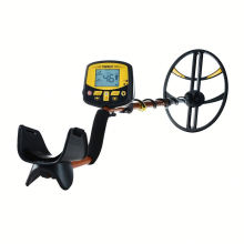


GPS Survey With Neck Lanyard And USB Cable High Accuracy ETrex GPS Outdoor Handheld
Product Description
Product Description
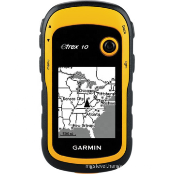
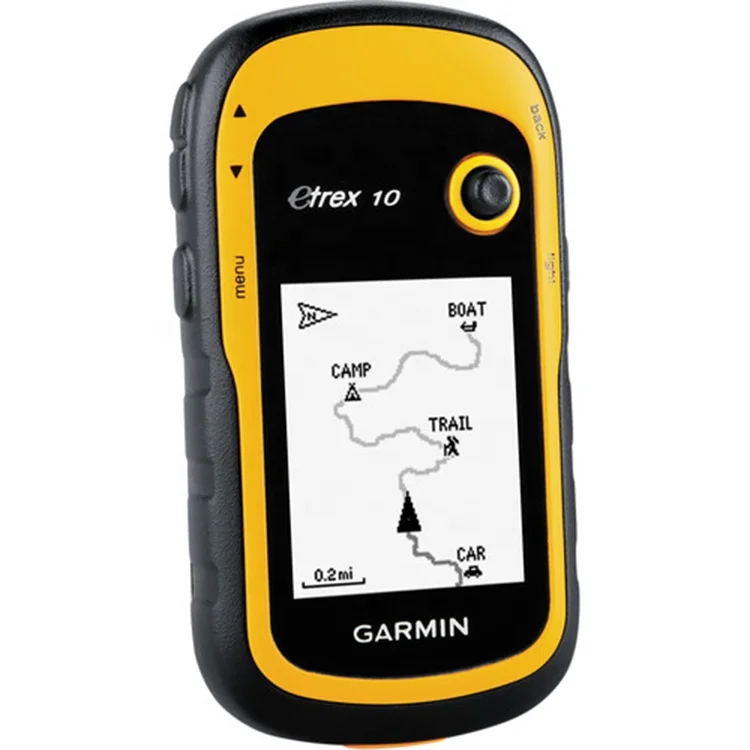
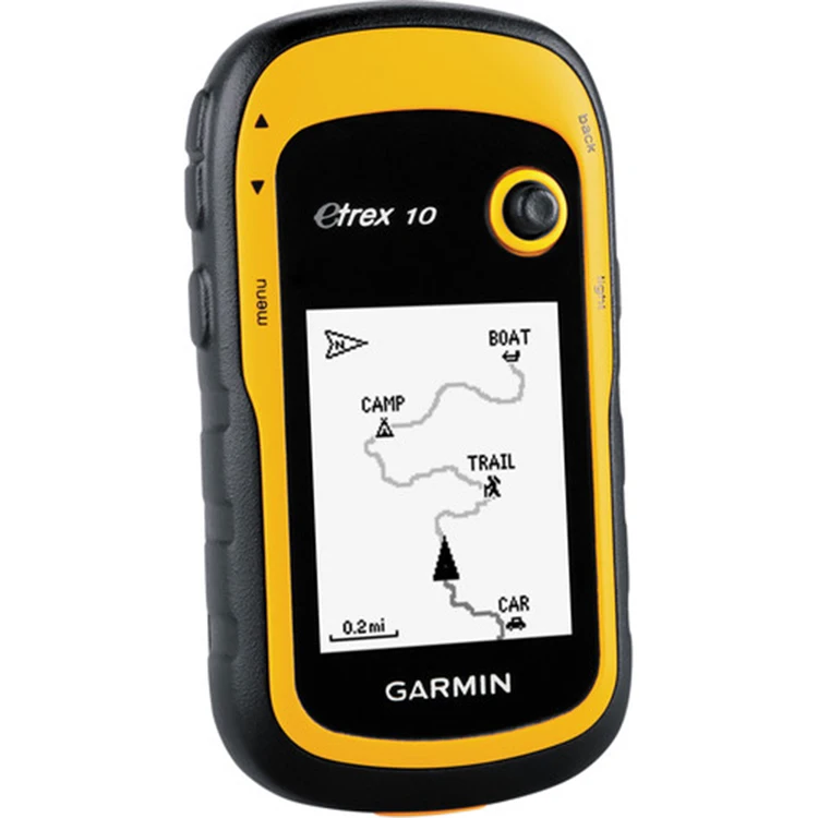
Garmin eTrex 10 handheld GPS Worldwide basemap 2.2" monochrome display, easy to read in any light GPS and GLONASS satellites for faster positioning Paperless geocaching 25-hour battery life with 2 AA batteries
eTrex 10 retains the core functionality, rugged construction, affordability and long battery life that made eTrex the most dependable GPS device available. We improved the user interface and added a worldwide basemap, paperless geocaching and support for spine-mounting accessories.
See the Way eTrex 10 has an enhanced 2.2" monochrome display that’s easy to read in any lighting situation. Both durable and water resistant, eTrex 10 is built to withstand the elements. Its easy-to-use interface means you’ll spend more time enjoying the outdoors and less time searching for information. eTrex 10 features the legendary toughness that’s built to withstand the elements. Dust, dirt, humidity, water — none are a match for this navigator.
Find Fun eTrex 10 supports geocaching GPX files for transferring geocaches. Visit OpenCaching to start your geocaching adventure. By going paperless, you're not only helping the environment but also improving efficiency. eTrex 10 stores and displays key information, including location, terrain, difficulty, hints and descriptions, which means no more manually entering coordinates and paper printouts. Simply upload the GPX file to your eTrex 10 and start hunting for caches.
Keep Your Fix With its high-sensitivity, WAAS-enabled GPS receiver and HotFix® satellite prediction, eTrex 10 locates your position quickly and precisely and maintains its GPS location even in heavy cover and deep canyons. Whether you’re in deep woods or just near tall buildings and trees, you can count on eTrex 10 to help you find your way when you need it the most.
Go Global eTrex devices are the first-ever consumer-grade receivers that can track both GPS and GLONASS satellites simultaneously. When using GLONASS satellites, the time it takes for the receiver to “lock on” to a position is (on average) approximately 20 percent faster than using GPS. And when using both GPS and GLONASS, the receiver has the ability to lock on to 24 more satellites than using GPS alone.
Plan Your Next Trip Take charge of your next adventure with BaseCamp™, software that lets you view and organize maps, waypoints, routes, and tracks. This free trip-planning software even allows you to create Garmin Adventures that you can share with friends, family or fellow explorers. BaseCamp displays topographic map data in 2-D or 3-D on your computer screen, including contour lines and elevation profiles.
General | ||
Physical dimensions | 2.1" x 4.0" x 1.3" (5.4 x 10.3 x 3.3 cm) | |
Display size, WxH | 1.4" x 1.7" (3.6 x 4.3 cm); 2.2" diag (5.6 cm) | |
Display resolution, WxH | 128 x 160 pixels | |
Display type | transflective, monochrome | |
Weight | 5 oz (141.7 g) with batteries | |
Battery | 2 AA batteries (not included); NiMH or Lithium recommended | |
Battery life | 25 hours | |
Water rating | IPX7 | |
High-sensitivity receiver | Yes | |
Interface | USB | |
Maps & Memory | ||
Basemap | Yes | |
Custom POIs (ability to add additional points of interest) | Yes | |
Waypoints/favorites/locations | 1000 | |
Routes | 50 | |
Track log | 10,000 points, 100 saved tracks | |
Outdoor Features | ||
Geocaching-friendly | Yes (Paperless) | |
Hunt/fish calendar | Yes | |
Sun and moon information | Yes | |
Area calculation | Yes | |
Garmin Connect | ||
Garmin Connect compatible (online community where you analyze, categorize and share data) | Yes | |


Specification
item | value |
Warranty | 1 years |
Certification | pcoc |
Customized support | OEM, ODM |
Place of Origin | China |
Brand Name | eTrex10 |
Barcode scanner | 1D/2D barcode scanner, NFC, GPS |
Product name | GPS Handheld |
Wifi | Support |
RAM | 2GB DDR3L |
Battery | 3.7V/ 5000mAh |
DC connector | 5V/3A |
Camera | Front 2.0MP, Rear 8.0MP |
Screen | 6" 720x1280 IPS |
Model Number | eTrex10 |
Application | gis collector |
Packing & Delivery

As is shown in the picture.
Company Profile


Zhenjiang Zhongtuo Electronic Technology Co., Ltd
FAQ
1.What kind payment method we accept? T/T, L/C at sight, Western Union, Trade Assurance on Alibaba, Moneygram and Paypal Note: Customer will be requested to pay 4% transaction fee upon total amount charged by EBAY 2.How can you guarantee payment safety ? Our company supports TRADE ASSURANCE service. If you will choose payment through ALIBABA TRADE ASSURANCE service, you payment will be guaranteed. Because we are not able to receive payment until you confirm goods receipt 3.What kinds of shipment for goods and how long time it takes ? Our company supports DHL, FEDEX, UPS, TNT, CHINA POST, by sea and other methods. Shipping time is 3-5 days from payment receipt 4.Does your company ship battery or not ? Our company can receive battery order and ship to customer normally, except a few special countries 5.Do you have other items not displayed on your website ? Yes, our company supplies full survey range products. If you are looking for product not displayed on our website. Please contact us freely. We will reply you on time
Product Categories : GPS
Premium Related Products


Hot Products
Construction & Remodel Professional Aluminum Box LevelConstruction Aluminum Frame Professional Box Level24' Professional Accuracy Construction Box Level24'' New Design Measuring Box LevelProfessional Aluminum Digital LevelConstruction and Decoration Heavy Duty Casting Spirit LevelProfessional Aluminum Box Level (600mm)Professional Heavy Duty Casting LevelHeavy Duty Aluminum Box LevelprofessionalHeavy Duty I-Beam Level700601Two Vials Heavy Duty Casting Level32`` Professional Box level with Two Handles18' Professional Accuracy Box LevelHigh Accuracy Magnetic Torpedo LevelTorpedo Magnetic Level10`` Aluminum Torpedo Level